
USDA Hardiness Zone
What are usda hardiness Zones?
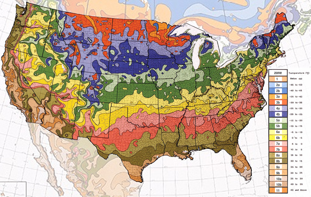
The USDA Makes color coded maps clearly showing the average winter temps in regions throughout the United States. Every couple of years they change the maps if average winter temps change. These maps are important tools to know what you can and can't grow outside depending on certain plants and trees cold hardiness. Each zone is in numerical order. Starting at zone 1 (the coldest) and ending at zone 11 (the warmest). Each zone is in ten degree increments and every zone having an A and B. Separating each zone into 5 degree increments. A always being the cooler side of every zone and B being the warmer side of every zone.